
#GeohazardAwareness #RiskAssessment #EnvironmentalManagement #GeohazardPrevention #ClimateChangeImpacts #DisasterRiskReduction #SustainableEnvironment #GeohazardMitigation #ResilientInfrastructure #EnvironmentalSustainability
Introduction to Geohazard risk assessment.
As engineers and construction professionals, we are constantly faced with the challenge of ensuring the safety and stability of our projects. One of the key factors that can pose a significant risk to construction projects is geohazards. Geohazards refer to geological hazards that can cause damage to infrastructure, property, and even human lives. These hazards can include earthquakes, landslides, and slope instability. To mitigate these risks and ensure the success of our projects, geohazard assessment plays a crucial role.
Geohazard Risk Analysis in Construction Projects.
When embarking on a construction project, it is essential to conduct a thorough geohazard risk analysis. This involves identifying and assessing the potential geohazards that may affect the project site. By understanding the specific geohazards associated with the location, engineers can develop appropriate strategies to mitigate the risks. This may involve implementing engineering controls, such as reinforced foundations or retaining walls, to withstand potential hazards. Additionally, geohazard risk analysis allows project managers to make informed decisions regarding site selection and design considerations.
Seismic Hazard Assessment for Infrastructure.
Earthquakes are the result of tectonic activity, occurring when stress accumulated along faults is released. The energy released during an earthquake can cause ground shaking, surface rupture, landslides, and tsunamis. Seismic hazard assessment involves the analysis of past seismic activity, fault lines, and geological conditions to estimate the potential ground shaking and associated risks in each area.
The Role of Seismic Hazard Assessment:
Designing Resilient Structures: Seismic hazard assessment provides critical information for engineers and architects to design structures that can withstand earthquakes. By considering factors such as ground motion characteristics, soil conditions, and local building codes, engineers can make informed decisions to enhance the seismic resilience of infrastructure.
Zoning and Land Use Planning: Seismic hazard assessment helps in determining appropriate land use zoning and planning regulations. Areas with higher seismic risks can be restricted from certain types of development or require more stringent building codes. This initiative-taking approach can minimize potential damage and save lives.
Retrofitting Existing Infrastructure: Seismic hazard assessment enables the identification of vulnerable structures that may require retrofitting to improve their resilience. By evaluating the structural integrity and vulnerability of existing infrastructure, engineers can prioritize retrofitting efforts and allocate resources effectively.
Geohazard Assessment for Land Development.
Geohazard assessment plays a crucial role in land development projects to ensure the safety and sustainability of infrastructure. Geohazards refer to natural hazards that can affect the stability and integrity of the land, such as landslides, earthquakes, floods, and volcanic eruptions. Assessing these hazards is essential to minimize risks and avoid potential disasters.
The first step in geohazard assessment is to gather detailed geological and geotechnical data about the site. This includes studying the topography, soil composition, groundwater levels, and geological history of the area. By analyzing this information, geotechnical engineers can identify potential hazards and assess their severity.
Land development projects, such as housing estates or industrial complexes, often involve extensive earthworks and excavation. These activities can significantly alter the natural terrain and increase the risk of geohazards, particularly landslides. Conducting a geohazard assessment for land development projects is crucial to identify areas of high landslide susceptibility and determine appropriate mitigation measures. This may involve slope stabilization techniques, such as terracing, retaining walls, or drainage systems, to prevent landslides and ensure the long-term stability of the developed land.
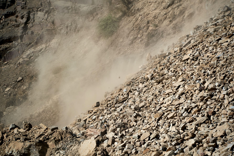
Landslide Susceptibility Mapping and Assessment.
Landslides are a common geohazard that can occur in various geological settings. To effectively manage the risk of landslides, engineers and geologists use advanced techniques, such as landslide susceptibility mapping and assessment. This involves analyzing the geological and topographic characteristics of an area to identify potential landslide-prone zones. By mapping the susceptibility of different areas, engineers can make informed decisions regarding land use planning, infrastructure design, and the implementation of appropriate landslide mitigation measures.
One common method used in landslide susceptibility mapping is the application of Geographic Information Systems (GIS). GIS allows engineers and geologists to overlay different layers of information and analyze the spatial relationships between several factors that contribute to landslide occurrence. This enables them to create susceptibility maps that highlight areas with high, moderate, or low susceptibility to landslides.
Another technique used in landslide susceptibility mapping is the development of statistical models. These models use historical landslide data and various environmental variables to create predictive models that can estimate the likelihood of landslides occurring in a particular area. The models are validated and calibrated using past landslide events, ensuring their accuracy and reliability.
Once the susceptibility maps are created, they can be used for various purposes. Land use planners can refer to these maps to determine suitable locations for infrastructure development, such as roads, buildings, and pipelines. By avoiding or minimizing construction in high-risk areas, the potential for damage and loss of life can be significantly reduced.
Geohazard Assessment in Slope Stability Analysis.
Geohazard assessment in slope stability analysis plays a vital role in ensuring the safety and reliability of infrastructure in geologically challenging environments. With the knowledge gained from slope stability analysis, engineers can identify potential failure mechanisms and design appropriate stabilization measures to mitigate the risks associated with unstable slopes. One of the key aspects of slope stability analysis is evaluating the factors that contribute to slope failure. These factors include the geological properties of the slope materials, such as soil type and strength, the presence of water, and external factors like seismic activity or human activities. By considering these factors, engineers can assess the likelihood of slope failure and determine the most suitable stabilization techniques.
Various slope reinforcement techniques can be employed based on the specific characteristics of the slope and the surrounding environment. Soil nails, for instance, are commonly used to reinforce slopes by drilling steel bars into the ground and grouting them with cement or other bonding agents. This technique improves the overall stability of the slope by increasing the shear strength of the soil.
Rock bolts, on the other hand, are long bolts that are inserted into the rock mass to enhance its stability. By providing additional support and preventing the movement of rocks, rock bolts effectively reduce the risk of slope failure.
Geosynthetic materials, such as geotextiles and geogrids, are often used as reinforcement in slope stability analysis. These materials are made of synthetic fibers and are designed to enhance the strength and stability of slopes. Geotextiles, for example, can be used to improve slope drainage and prevent the erosion of soil particles, while geogrids can provide tensile strength and increase the stability of the slope.
Geohazard Mitigation Strategies and Techniques.
To effectively mitigate the risks associated with geohazards, it is crucial to implement a range of strategies and techniques. Engineering controls are often employed to enhance the structural integrity of infrastructure and protect it from potential geohazard impacts. These controls may involve the use of advanced materials, reinforcements, or specific design considerations to ensure the stability of buildings, bridges, or other structures. For example, in areas prone to earthquakes, engineers may incorporate flexible building designs or base isolation systems to absorb and dissipate seismic energy.
Non-structural measures are equally important in geohazard risk mitigation. Early warning systems can provide critical information to alert communities about impending geohazard events, such as landslides or volcanic eruptions, giving them valuable time to evacuate or take necessary precautions. Emergency preparedness plans are also essential, as they outline the procedures and protocols to be followed in the event of a geohazard occurrence. These plans may include evacuation routes, communication strategies, and coordination with local authorities and emergency response teams.
Community Resilience to Geohazard Events.
Community resilience is a crucial aspect of geohazard management that cannot be overlooked. Engaging with local communities not only helps in understanding their needs and concerns but also allows for the exchange of knowledge and expertise. By establishing effective communication networks, engineers can effectively disseminate information about geohazards, their potential impacts, and the necessary safety precautions.
Education plays a significant role in building community resilience. By organizing workshops, seminars, and awareness campaigns, engineers can empower residents with the knowledge to recognize early warning signs and respond appropriately during geohazard events. This includes teaching them about evacuation routes, safe shelter locations, and emergency supplies.
Furthermore, developing robust emergency response plans is critical. These plans should outline the roles and responsibilities of different stakeholders and establish clear communication channels. Regular drills and exercises can help familiarize the community with the response procedures, ensuring a more efficient and coordinated reaction during actual emergencies.
In addition to immediate response efforts, long-term planning is also necessary. This involves implementing measures to reduce the vulnerability of communities to geohazards, such as land-use planning, zoning regulations, and infrastructure improvements. Engineers can contribute by designing and implementing sustainable solutions that minimize the impact of geohazards on communities, such as reinforced buildings, slope stabilization techniques, and drainage systems.
Conclusion: The Future of Geohazard Assessment in Transforming Industries.
Geohazard assessment plays a crucial role in achieving engineering excellence and driving advancements in various industries. To effectively tackle the challenges posed by geohazards, it is imperative to conduct comprehensive assessments and implement suitable mitigation measures. The future of geohazard assessment lies in the continuous advancement and application of innovative technologies like remote sensing, geospatial analysis, and numerical modeling. These innovative tools empower engineers to gain a deeper understanding of geohazard risks, design resilient structures, and foster sustainable development within our communities.
As a geohazard assessment company, we are fully committed to ensuring the success of your construction projects. Our services encompass a wide range of expertise, including geohazard assessment, landslide risk analysis, earthquake hazard assessment, slope stability analysis, and more.
We also answer questions about other aspects of soil testing, geophysical surveys, water resources, and environmental management. Message us to schedule a free consultation. We are here to assist you in ensuring the success of your construction projects.

Comments