
#GeohazardAwareness #RiskAssessment #EnvironmentalManagement #GeohazardPrevention #ClimateChangeImpacts #DisasterRiskReduction #SustainableEnvironment #GeohazardMitigation #ResilientInfrastructure #EnvironmentalSustainability
What is geohazard assessment?
Geohazard assessment is the process of identifying, evaluating, and understanding the potential risks and hazards associated with geological phenomena. These hazards can include earthquakes, landslides, volcanic eruptions, and flooding. By conducting a thorough geohazard assessment, businesses can better understand the potential risks to their operations and act appropriately to mitigate these risks.
Geohazard assessments typically involve gathering and analyzing data related to the geological features of an area, such as the presence of fault lines, the stability of slopes, and the likelihood of volcanic activity. This information is then used to assess the potential impact of geological hazards on a business's infrastructure, operations, and personnel. By understanding these risks, businesses can develop strategies to minimize their exposure and ensure the safety and continuity of their operations.
Why is geohazard assessment important?
Geohazard assessment is crucial for businesses operating in areas prone to geological hazards. These hazards can have devastating consequences, including property damage, loss of life, and disruptions to business operations. By conducting a geohazard assessment, businesses can identify potential risks and take proactive measures to reduce their vulnerability.
One of the key reasons why geohazard assessment is important is to ensure the safety of employees and customers. By understanding the potential risks posed by geological hazards, businesses can implement safety measures and emergency response plans to protect their personnel and visitors. This can include evacuation plans, training programs, and the installation of safety equipment.
Another important aspect of geohazard assessment is risk management. By identifying and evaluating potential hazards, businesses can develop strategies to mitigate their impact. This can include implementing engineering controls, such as reinforcing buildings and infrastructure to withstand earthquakes or landslides or relocating operations to less hazardous areas. By taking these proactive measures, businesses can minimize the financial and operational risks associated with geological hazards.
What are the geological hazard examples in the Philippines?
The Philippines is a country with diverse geological features, which makes it prone to various geological hazards. Some of the common geological hazards in the Philippines include earthquakes, volcanic eruptions, landslides, and flooding.
Earthquakes are a significant geological hazard in the Philippines due to its location along the Pacific Ring of Fire. The country experiences frequent seismic activity, with several active fault lines. These earthquakes can cause severe damage to infrastructure and pose a threat to the safety of people.
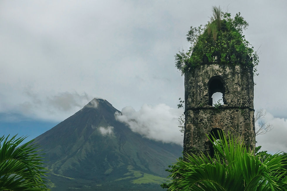
Volcanic eruptions are another major geological hazard in the Philippines, with several active volcanoes, including Mount Mayon and Mount Pinatubo. These eruptions can release ash clouds, pyroclastic flows, and lahars, which can cause widespread damage and disrupt transportation and communication networks.
Landslides are also a common geological hazard in the Philippines, especially in mountainous regions. Heavy rainfall, deforestation, and improper land use can increase the susceptibility of slopes to landslides, which can result in property damage and loss of life.
Flooding is a recurring geological hazard in the Philippines, particularly during the typhoon season. The country's topography, combined with its high rainfall intensity, makes it prone to flash floods and riverine flooding, which can cause extensive damage to infrastructure and agriculture.
How do you prepare for a geohazard?
Preparing for a geohazard involves a combination of proactive measures and emergency response planning. Here are some steps to consider when preparing for a geohazard:
1. Risk assessment: Conduct a geohazard assessment to understand the potential risks and hazards in your area. This can involve studying geological maps, consulting with experts, and analyzing historical data on geological events.
2. Mitigation measures: Implement engineering controls and structural modifications to reduce the vulnerability of your infrastructure to geological hazards. This can include reinforcing buildings, constructing retaining walls, and implementing drainage systems to minimize the impact of flooding.
3. Emergency response planning: Develop and communicate an emergency response plan to ensure the safety of your employees and customers. This can include evacuation procedures, designated safe areas, and training programs to educate personnel on how to respond to different geological hazards.
4. Monitoring and early warning systems: Install monitoring equipment and establish early warning systems to detect and alert you to potential geological hazards. This can include seismic sensors, volcanic gas monitoring, and rainfall gauges to provide timely information for decision-making.
5. Regular drills and exercises: Conduct regular drills and exercises to evaluate the effectiveness of your emergency response plan and ensure that personnel are prepared to respond to different geological hazards. This can help identify areas for improvement and build a culture of safety within your organization.
By taking these preparatory measures, businesses can minimize their vulnerability to geological hazards and ensure the safety and continuity of their operations.
How can we prevent geohazards?
While it is not possible to completely prevent geological hazards, there are measures that can be taken to reduce their impact.
Here are some strategies for preventing geohazards:
1. Land use planning: Develop and enforce land use policies that consider the geological hazards in the area. This can include zoning regulations to restrict development in high-risk areas, such as floodplains or landslide-prone slopes.
2. Environmental management: Implement environmental management practices to preserve and protect natural resources, which can help prevent or reduce the occurrence of certain geological hazards. This can include reforestation programs, soil erosion control measures, and watershed management initiatives.
3. Infrastructure design and construction: Incorporate geohazard considerations into the design and construction of infrastructure projects. This can include engineering controls, such as building codes that require structures to be designed to withstand seismic activity or landslides.
4. Early warning systems: Invest in the development and implementation of early warning systems for geological hazards. This can include real-time monitoring of seismic activity, volcanic gas emissions, and rainfall intensity, coupled with effective communication channels to disseminate warnings to the public.
5. Education and awareness: Promote education and awareness about geological hazards among the public, businesses, and government agencies. This can include public information campaigns, training programs, and workshops to educate individuals on how to recognize and respond to different geological hazards.
By adopting these preventive measures, businesses and communities can reduce their exposure to geological hazards and minimize the potential damage and loss associated with these events.
What do you think is the purpose of geohazard map?
The purpose of a geohazard map is to provide valuable information about the potential risks and hazards associated with geological phenomena in a specific area. Geohazard maps are typically developed by experts in the field of geology and are used by businesses, government agencies, and communities to make informed decisions regarding land use, infrastructure development, and emergency planning.
Geohazard maps provide a visual representation of the geological hazards in an area, including the location and extent of fault lines, areas prone to landslides, volcanic hazard zones, and flood-prone areas. This information can help businesses and communities identify high-risk areas and act appropriately to reduce their vulnerability.
Geohazard maps also serve as a tool for emergency planning and response. By understanding the potential hazards in an area, emergency management agencies can develop strategies to mitigate the impact of geological events and ensure the safety of the public. This can include the establishment of evacuation routes, the identification of safe areas, and the development of communication networks to disseminate warnings and updates during emergencies.
Furthermore, geohazard maps can be used in the decision-making process for infrastructure development projects. By considering the potential geological hazards in a specific area, engineers and planners can design and construct structures that are resilient and able to withstand these hazards. This can help reduce the risk of damage to infrastructure and ensure the long-term sustainability of development projects.
In conclusion, geohazard maps play a crucial role in informing decision-making, promoting safety, and ensuring the sustainability of businesses and communities in areas prone to geological hazards.
Methods for geohazard assessment and monitoring
Geohazard assessment and monitoring involve the use of various methods and techniques to gather data and analyze the potential risks and hazards associated with geological phenomena.
Here are some common methods used in geohazard assessment and monitoring:
Remote sensing: Remote sensing involves the use of satellite imagery, aerial photography, and LiDAR (Light Detection and Ranging) technology to gather information about the geological features of an area. This can include identifying fault lines, mapping landforms, and detecting changes in topography that may indicate the potential for landslides or volcanic activity.
Geological mapping: Geological mapping involves the collection and analysis of geological data, such as rock formations, soil types, and structural features. This information is used to understand the geological history of an area and assess the potential risks and hazards associated with specific geological features.
Geophysical surveys: Geophysical surveys use various techniques, such as seismic surveys, ground-penetrating radar, and electrical resistivity surveys, to gather information about the subsurface geology of an area. This can help identify subsurface faults, determine the stability of slopes, and detect the presence of underground water sources that may contribute to landslides or flooding.
Seismic monitoring: Seismic monitoring involves the installation of seismometers and other instruments to detect and record seismic activity in an area. This information is used to assess the potential for earthquakes and volcanic eruptions and to monitor ongoing activity.
Volcanic gas monitoring: Volcanic gas monitoring involves the measurement and analysis of gases emitted by active volcanoes. Changes in gas composition and emission rates can provide valuable information about the potential for volcanic eruptions and the movement of magma beneath the surface.
Rainfall monitoring: Rainfall monitoring involves the collection and analysis of rainfall data to assess the potential for flooding and landslides. This information is used to identify areas with high rainfall intensity and to develop models that can predict the likelihood of these events occurring.
By combining these methods and techniques, geohazard assessment and monitoring can provide valuable insights into the potential risks and hazards associated with geological phenomena. This information is crucial for businesses, government agencies, and communities to make informed decisions and act appropriately to mitigate these risks.
Benefits of geohazard assessment for sustainable business practices
Geohazard assessment offers several benefits for businesses looking to adopt sustainable practices.
Here are some of the key benefits:
Risk management: Geohazard assessment allows businesses to identify and evaluate potential risks and hazards associated with geological phenomena. By understanding these risks, businesses can develop strategies to minimize their exposure and ensure the continuity of their operations. This can help reduce financial and operational risks and contribute to long-term sustainability.
Safety and well-being: Geohazard assessment ensures the safety and well-being of employees, customers, and communities. By understanding the potential risks posed by geological hazards, businesses can implement safety measures and emergency response plans to protect personnel and visitors. This can help prevent injuries, loss of life, and damage to property.
Resilient infrastructure: Geohazard assessment helps businesses design and construct infrastructure that is resilient and able to withstand geological hazards. This can include reinforcing buildings, implementing drainage systems, and using appropriate materials and construction techniques. Resilient infrastructure reduces the risk of damage and downtime, ensuring the continuity of operations and minimizing the environmental impact.
Regulatory compliance: Geohazard assessment helps businesses comply with regulatory requirements related to environmental management and safety. Many authorities require businesses to conduct geohazard assessments as part of the permitting and approval process for development projects. By conducting these assessments, businesses can demonstrate their commitment to compliance and sustainability.
Stakeholder engagement: Geohazard assessment provides businesses with an opportunity to engage with stakeholders, including communities, government agencies, and non-governmental organizations. By sharing information and collaborating on geohazard assessment and mitigation strategies, businesses can build trust and enhance their reputation as responsible and sustainable organizations.
Incorporating geohazard assessments into business strategies contributes to the overall sustainability and resilience of operations. By understanding and mitigating geological hazards, businesses can minimize risks, protect personnel and assets, and contribute to the well-being of communities and the environment.
Conclusion: Integrating geohazard assessments into business strategies for sustainability
Geohazard assessments are essential for businesses operating in areas prone to geological hazards. By conducting thorough assessments, businesses can identify potential risks and hazards, develop strategies to mitigate these risks, and ensure the safety and continuity of their operations. Geohazard assessments involve the use of various methods and techniques, such as remote sensing, geological mapping, geophysical surveys, and seismic monitoring. These methods provide valuable insights into the potential risks and hazards associated with geological phenomena, enabling businesses to make informed decisions and act appropriately to reduce their vulnerability.
Integrating geohazard assessments into business strategies offers several benefits for sustainable practices. These include risk management, safety and well-being of personnel and visitors, resilient infrastructure, regulatory compliance, and stakeholder engagement. In conclusion, geohazard assessments are a crucial component of sustainable business practices. By understanding and mitigating geological hazards, businesses can minimize risks, protect assets, and contribute to the resilience of operations. It is essential for businesses to prioritize geohazard assessments and incorporate them into their decision-making processes to ensure the long-term sustainability and success of their operations.
We also answer questions about other aspects of soil testing, geophysical surveys, water resources and environmental management. Message us to schedule a free consultation. We are here to assist you in ensuring the success of your construction projects.

Comentarios