
Introduction to Seismic Analysis.
Seismic analysis is a technique used to analyze the data collected from geophysical surveys. The most common use of seismic analysis is in oil and gas exploration, but it can be used in many industries including civil & infrastructure, water resources, environmental management and mining and geology studies. Seismic data can be gathered in many ways, including air guns, metal plates and hammers and small synthetic explosions. The collected information must be analyzed by engineers with special training who can process and analyze it so that the client companies get useful results.
Fundamentals concepts for Seismic Analysis.
Seismic analysis is the study and interpretation of seismic data. Seismic data is collected by geophones or seismometers which measure ground motion during an earthquake or other seismic source. The raw data is in the form of a time series of ground motion readings in meters per second (m/s). Seismic analysis is performed on this data to determine the possible effects of several types of geological events such as earthquakes, liquefaction, and volcanic activity in infrastructures related to geotechnical engineering.
In general, there are two types of seismic sources: natural and synthetic. Natural sources include earthquakes, volcanic eruptions, and landslides. Artificial sources include small explosions, plate and hammer striking and pressurized air guns in boats used by geologists to map rock layers underground or by mining companies who use them locate fault lines, ore deposits.
The processing of the data recorded from these tests is used to determine characteristics of the subsurface, such as its depth below bedrock or water table; permeability; porosity; density variations within layers.
Seismic Analysis for Geotechnical Engineering
Seismic analysis is used to determine the strength of seismic activity in an area. This information can be useful for building design and safety purposes in geotechnical engineering. Seismic analysis helps engineers understand the stress levels and geological structures present in an area during an earthquake. It is important that you use this information to create structures that are both strong enough and stable.
In Geotechnical Engineering, to test the soil is an essential step in the construction of any structure that will be supported by concrete foundations. A soil test can reveal information about the type, depth, and suitability of your building site's soil for construction. It can also help you avoid the cost of building on unsuitable land and protect your investment from unexpected costs later.
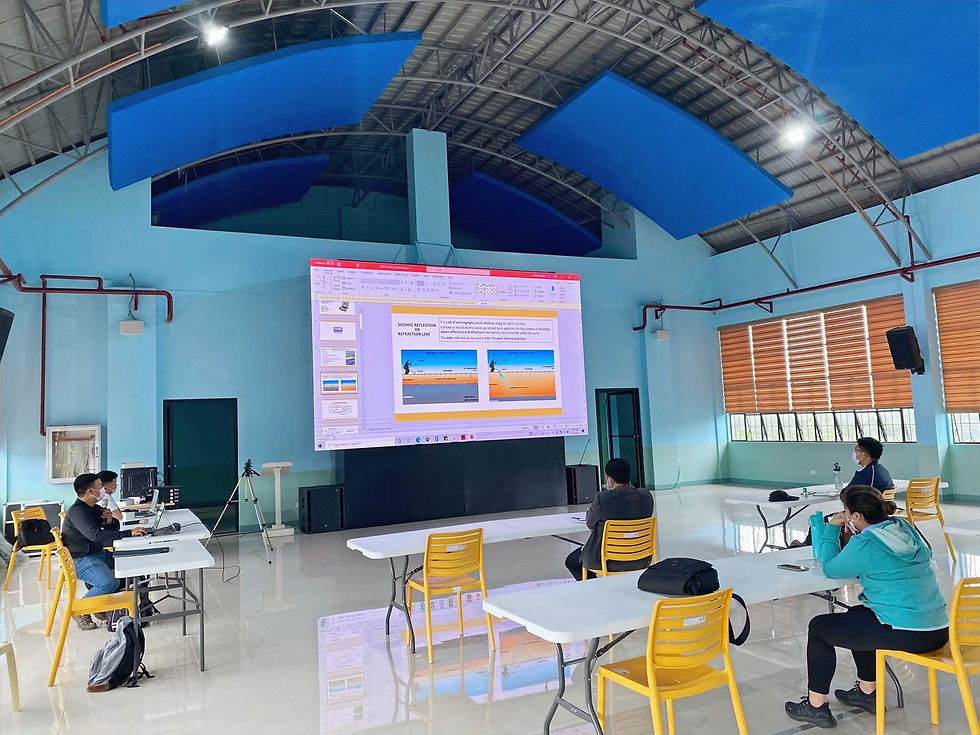
Teaching Seismic Analysis: Methods & Recommendations.
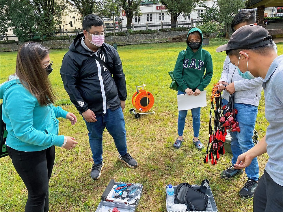
Field survey methods include the use of geophones, which are usually placed on a grid pattern and connected to cables that run back to an array controller or recorder. The data from each recording channel is sent to an individual computer for processing, then combined into a single file and converted into a cross-sectional diagram for geotechnical engineering analysis.
MULTI-CHANNEL ANALYSIS OF SURFACE WAVES (MASW)
This method uses multiple geophones in a single recording system to provide a more detailed image of the subsurface. The data from each channel is sent to its own computer for processing, then combined into a single file and converted into a cross-sectional diagram.
SEISMIC REFRACTION
Seismic Refraction is a technique used to measure the velocity of subsurface materials. Refraction occurs when waves are transmitted through layers with different velocities. The difference in travel time between the two paths, known as “time of arrival” or TOA, can be measured and used to calculate the velocity of each layer. Refraction analysis is an important part of understanding how fluid flows through geologic structures. It provides information on the location, size and shape of reservoir formations and helps determine permeability values for hydrocarbon-bearing rocks.
PASSIVE SEISMIC DATA COLLECTION
A Passive seismic method such as the Horizontal to Vertical Spectral Ration (HVSR) would depend on the natural remnant seismic waves existing around the area of interest to penetrate greater depth of investigation and accurate subsurface reactions to ground shaking. This method is based on the principle that several types of rock conduct seismic waves differently. Therefore, by measuring the ratio of vertical to horizontal signals at various frequencies—and analyzing that data—it is possible to conclude what type of subsurface geology exists.
LEARNING & ANALYSIS RECOMMENDATIONS.
Adult learners learn best by solving problems and learning from their own mistakes. Some have a great deal of expertise that can benefit the whole team if they share it. Diving the group into two teams in random order to enable other members of the team to learn by sharing. It also creates an environment of competition which encourages learners to complete the goal faster to win the contest.
Geologic materials are complex, with differing amounts of moisture and grain size depending on the location where they are present. The Seismic analysis measures an inverse property based on geologic assumptions and soil composition based on geotechnical engineering. It is the duty of the trainer to differentiate and elicit the properties required for a comprehensive analysis.
Field survey configurations must be strictly followed as these are the regular controls during data collection. In example, to penetrate the required depth of investigation the geophone spacing must be adjusted accordingly to the fundamental concept of seismic data acquisitions. Excessive Geophysical noise is also a common mistake for new end-users.
The data processing must include the processor’s experience and judgment, gained through working extensively and reading geotechnical engineering scientific journals on previous works related to the topic of interest to correlate the values accurately.
How our team can help you.
Our instructors have expertise in seismic analysis and geotechnical engineering and we focus on the fundamentals. We give your engineers and technicians the foundation they need to become experts in their fields.
To do this we created a step-by-step guide on how to process data and collected it from different areas of the city so they could see what worked best. We then engaged in a discussion to help them uncover their own ideas, as well as correct any misconceptions. Lastly, we provided the participant with relevant journals and studies related to the specific survey methods in seismic analysis.
Our conceptual framework is based on Fundamental Concepts and their diverse applications. Our team has minimized the presence of engineering equations to make it easier for our audience. Instead, we will show them simplified diagrams of how the computer software processes data relevant to inversion for geologic models.
Our program covers:
The fundamental concepts in seismic analysis.
The fundamentals of seismic analysis software applications, models, output and tools.
Field Data Gathering.
Data Interpretation and Correlation with geotechnical engineering standards.
CONCLUSION
This is a terrific way to train your engineers for seismic analysis. By using this method, you will be able to train more people in less time and help them become better at their job.
Our team sells equipment related to seismic analysis, and we conduct the relevant training for our customers. If you find this information useful, please share it on Facebook or LinkedIn—other people might be interested in learning about our work!
We also answer questions about other aspects of soil testing, geophysical surveys, and environmental management. Just leave us a message!

Comments